


Demonstrations
Study of Social Reverse Geocoding: Visualizing peoples’ City Images on the map Using Geotagged Social Tagging
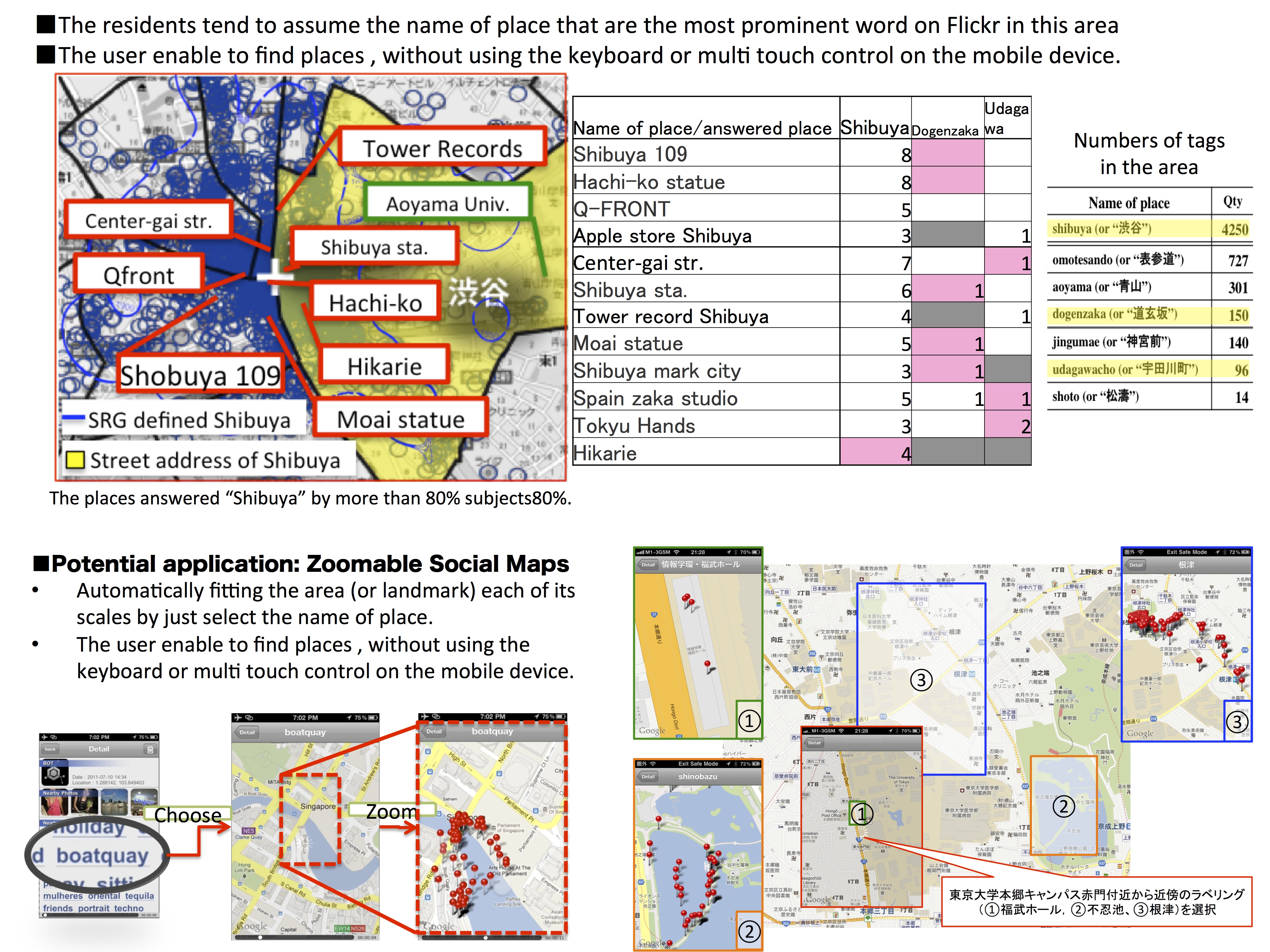
Owing to the increasing use of social networking in the mobile environment, people today share more than a million geotagged objects that include objects with social tagging on a daily basis. In this paper, we propose social reverse geocoding (SRG). Social reverse geocoding (SRG) provides highly descriptive geographical information to mobile users. GPS provides the user with latitude and longitude values; however, these values are cumbersome for determining a precise location. A traditional reverse geocoding (conversion of the abovementioned values into street addresses) provides location information based on administrative labeling, but people often do not recognize locations or their surrounding environments from street addresses alone. To address this problem with location recognition, we have created SRG, a reverse geocoding system that enhances location data with user-generated information and provides assistance through a mobile interface[1]. Through a user study of SRG, we found a clear correlation between the number of tags and the locality of the residents. The obtained result indicates that the residents define the area of a city through SRG as closer than that defined by its street address. Further, the result reveals the potential of developing location-based services based on the image of the city obtained using social tagging on the Internet.
Koh Sueda
National University of Singapore